
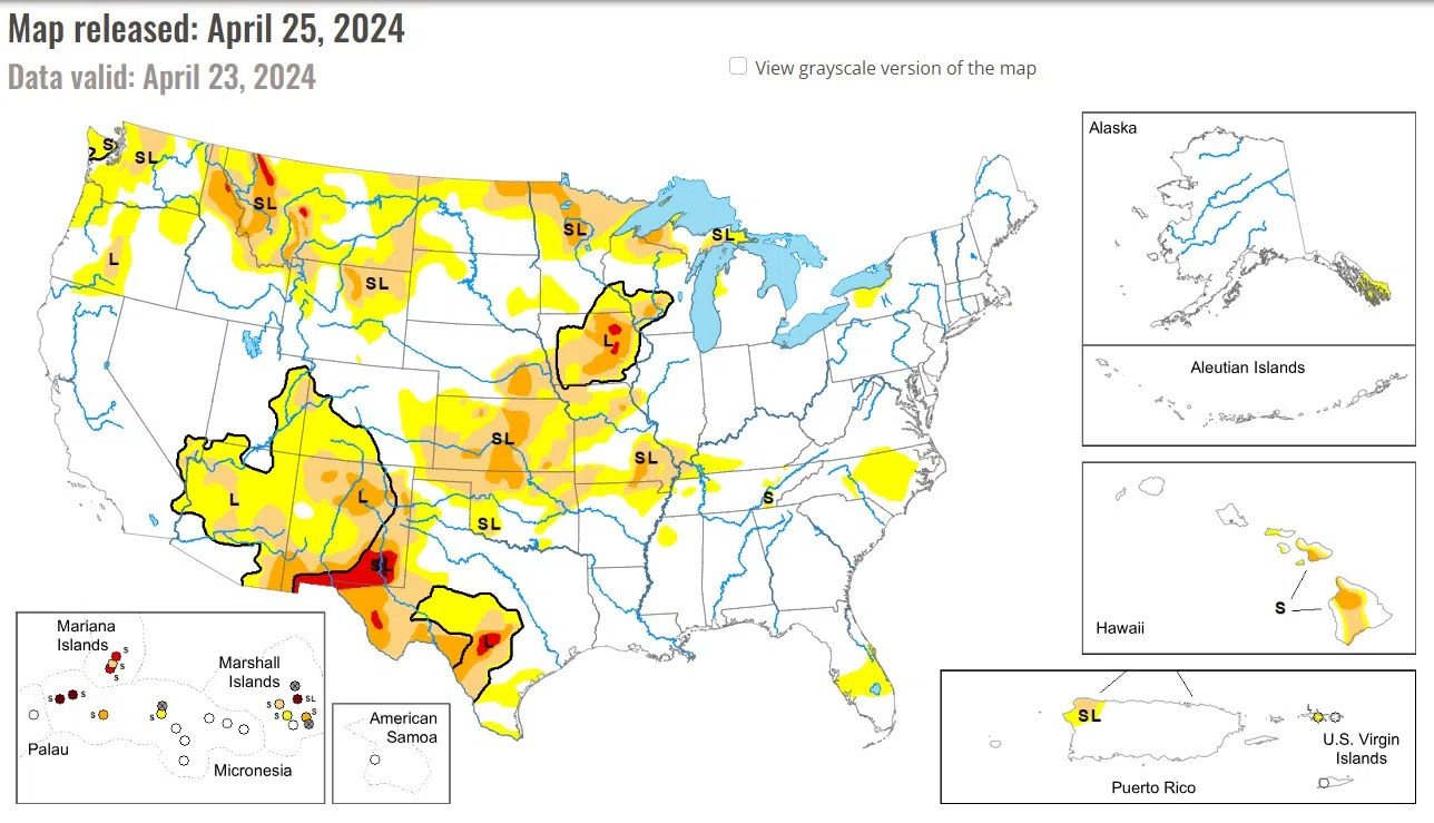
This U.S. Drought Monitor week saw improvements on the map in drought-affected areas of the Southwest, Northern Plains, and the Midwest while conditions deteriorated in areas of the Pacific Northwest, Eastern Plains of Colorado and Montana, Southern Plains, and the South.
Wetter-than-normal conditions have prevailed during the past 30-60 days in portions of the Midwest leading to widespread improvements across drought-affected areas of Iowa, Minnesota, Wisconsin, and Michigan.
For the week, light-to-moderate precipitation accumulations (generally < 2 inches) were observed in the Midwest region with the heaviest accumulations logged in isolated areas of southern Minnesota, southern and northeastern Iowa, southeastern Missouri, southern Illinois, and southwestern Indiana. Average temperatures for the week were below normal (2 to 6 degrees F) across the western half of the region with the greatest anomalies observed in eastern Iowa and central Illinois.
For the week in the High Plains, average temperatures were below normal (2 to 10+ degrees F) with the greatest departures observed in western portions of the Dakotas and Nebraska as well as along the eastern plains of Wyoming and Montana. Overall, the region was generally dry during the past week except for a few areas that benefitted from isolated shower activity in northeastern Kansas, north central and northeastern Nebraska, and southwestern South Dakota.
National Drought Mitigation Center, University of Nebraska-Lincoln


Comments