
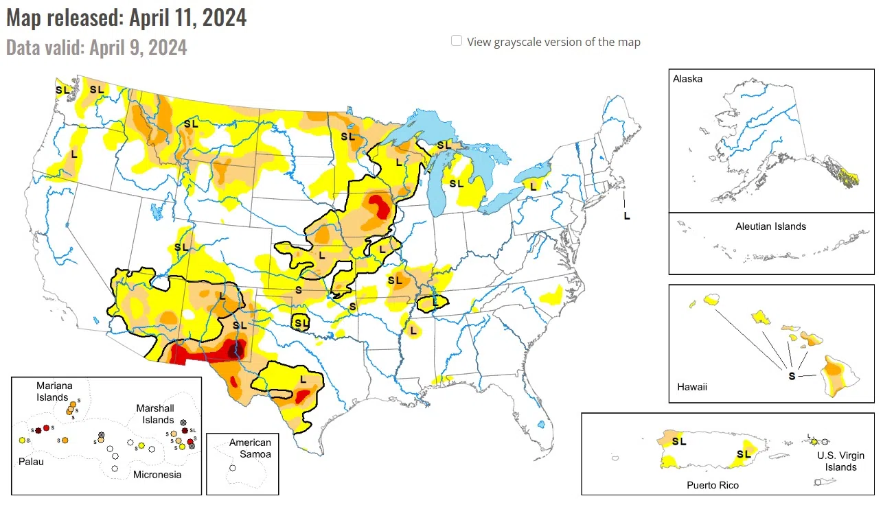
Following the El Nino winter and an active early spring pattern, drought coverage is at its lowest since the spring 2020. A strengthening low pressure system and trailing cold front progressed east from the Mississippi Valley to the East Coast at the beginning of April. This storm brought heavy snow (6 to 18 inches, locally more than 2 feet) to the Upper Peninsula of Michigan, Wisconsin, and northern New England. The recent precipitation (rain and snow) during the past few weeks continued to ease drought conditions across the Upper Midwest.
Widespread rain and snow (1 to 2 inches of precipitation, liquid equivalent) on April 7 led to a 1-category improvement across parts of northeastern Wyoming and western South Dakota. Following another week of precipitation along with considerations of soil moisture, abnormal dryness (D0) coverage was reduced throughout the Dakotas. A strengthening low pressure system on April 6 and 7 brought high winds to the Great Plains which dried out topsoil especially across Kansas and southeastern Colorado.
On April 2nd, a swath of heavy precipitation (1 to 2 inches, liquid equivalent) was observed across eastern Iowa, northwestern Illinois, and parts of Wisconsin. This recent precipitation along with considerations of long-term indicators supported a 1-category improvement to these areas. Moderate drought (D1) and abnormal dryness (DO) was reduced across the Upper Peninsula of Michigan along with the northern shore of Lake Superior in northeastern Minnesota as shorter term SPIs are either neutral or positive. More precipitation overspread the Upper Midwest on April 6 and 7 which also supports the decreasing coverage and intensity of drought across this region since mid-March.
National Drought Mitigation Center, University of Nebraska-Lincoln


Comments