
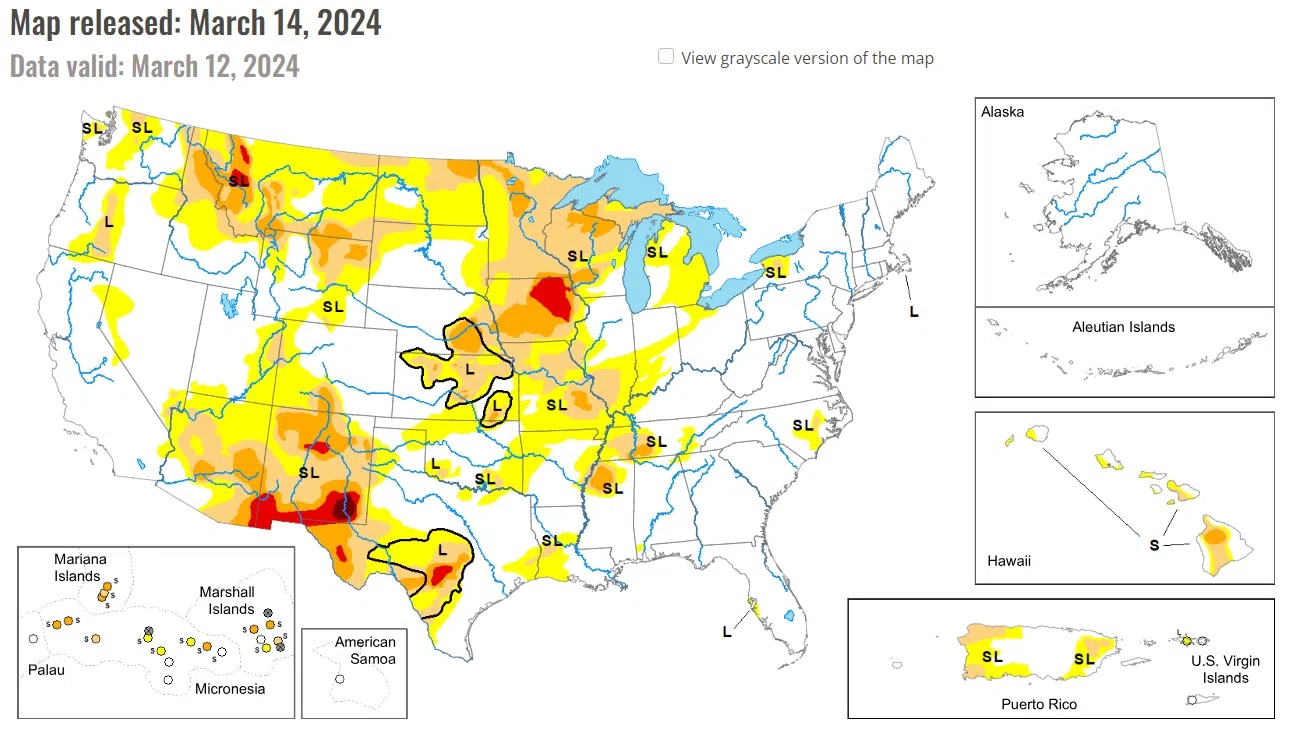
According to the latest U.S. Drought Monitor, the central third of the contiguous U.S. saw a mix of improvements and degradations, based on where heavier precipitation did or did not fall and where dry and windy conditions continued. Parts of Illinois, Indiana, Ohio, the Michigan Lower Peninsula, southern Missouri and southeast Kansas saw improving conditions after heavier rains fell there. Meanwhile, moderate drought expanded in northwest Missouri and portions of west-central Wisconsin, Minnesota, northwest Iowa, the far southern Michigan Upper Peninsula and far northeast Wisconsin.
Eastern parts of the High Plains region were mostly warmer than normal this week, with temperatures 8-10 degrees above normal occurring in the eastern Dakotas. Colder-than-normal weather occurred in western Wyoming and parts of Colorado. Recent dry, warm and windy weather led to a small expansion of abnormal dryness in northeast Nebraska and far southeast South Dakota. In northeast Wyoming and adjacent southwest South Dakota, recent dry, warm and windy weather led to expansions of abnormal dryness and moderate and severe drought.
A few areas of precipitation occurred in Iowa and southern Wisconsin, but northern Iowa, central and northern Wisconsin, Minnesota and the Upper Peninsula of Michigan were mostly dry this week. Low snowpack, decreasing soil moisture and dry and warm weather from the last couple months led to expansions in moderate drought in west-central Wisconsin; northeast Wisconsin and the southern Michigan Upper Peninsula; northeast, south-central and southwest Minnesota; and northwest Iowa.
National Drought Mitigation Center, University of Nebraska-Lincoln


Comments