FARGO, N.D. (KFGO) – The Saturday storm developed in northeast South Dakota and tracked across portions of extreme southeast North Dakota, west-central Minnesota, and into southern portions of northwest Minnesota from mid-afternoon into the evening hours according to the National Weather Service in Grand Forks.
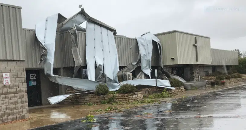
The system produced downburst winds, heavy rain, and two confirmed tornadoes. An EF-1 twister with estimated peak winds of 100 mph touched down in Park Rapids about 10:35 p.m. It first tracked to the northwest, and across the Hwy 71 roundabout onto the Faithbridge Church property where it tore off large metal roof panels from the church, then northward along an alley, and northeastward onto the Park Rapids Ford property. Additional roofing panels and siding were torn from the automobile dealership structure. The tornado was on the ground for a little more than a quarter-mile.
In southeast North Dakota, A trained spotter reported and video captured a brief tornado near North Dakota Highway 18 South Southeast of Lidgerwood. The EF-0 tornado, with estimated peak winds of 70 mph touched down briefly over an open field and tracked for a tenth of a mile or less to the North Northeast before dissipating. There were no injuries in either touch-down.
In Fergus Falls, straight-line winds also downed trees and knocked out power to more than 4200 Otter Tail Power customers. Crews worked into Sunday to fully restore power.


Comments