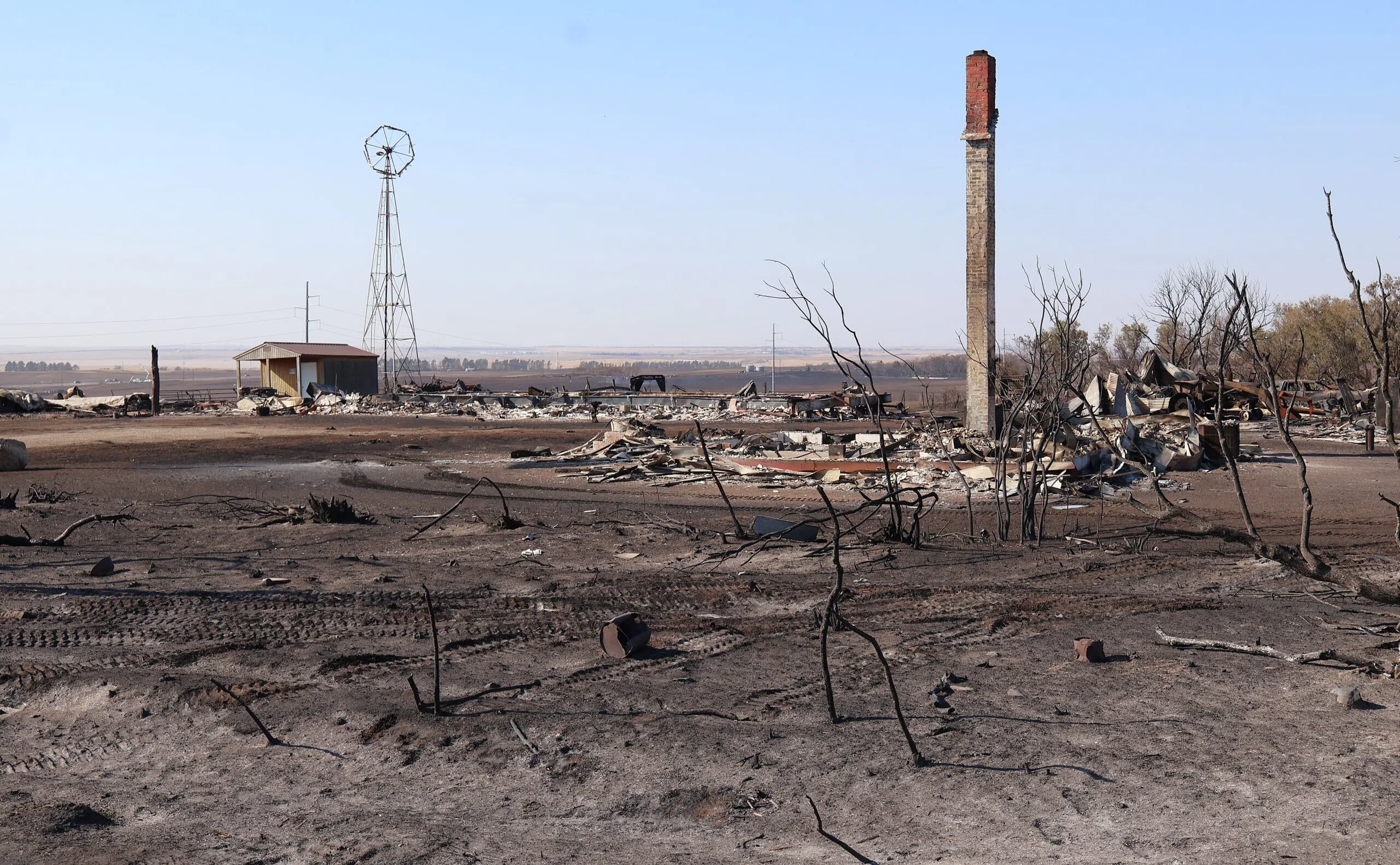
The remaining structures of the Holte farmstead sit on 109th Avenue, between Ray and Tioga, N.D., on Oct. 9, 2024. (Jacob Orledge/North Dakota Monitor)
By: Jeff Beach and Amy Dalrymple
RAY, N.D. (North Dakota Monitor) – At least three government agencies will investigate the causes of wildfires that have burned more than 110,000 acres in North Dakota in the last week.
State-led investigations into four wildfires in northwest North Dakota are in the early stages, but preliminary findings indicate there’s no evidence the fires were intentionally set, State Fire Marshal Doug Nelson said Thursday.
State investigators were asked to look into the fire near Tioga that involved two fatalities, a fire near Ray, a fire near Keene and a fire near New Town, Nelson said.
The state fire marshal will investigate if a local fire department requests an investigation. But if the fire occurs on federal land, then a federal agency is likely involved, said Jacob Just, director of communications for the North Dakota Insurance Department.
Steve Best of the U.S. Forest Service said Thursday it has brought in an investigator to try to determine the cause of the Elkhorn Fire south of Watford City. The investigator will work with Forest Service and local law enforcement.
The federal Bureau of Alcohol, Tobacco and Firearms on Thursday confirmed it is investigating the Bear Den Fire on the Fort Berthold Reservation.
The four investigations the state fire marshal is handling are expected to take one to two months. In addition to the on-scene investigation, the probes will involve interviews and evaluating data that was collected, Nelson said.
Nelson urged the public to continue taking precautions to minimize fire risk.
“We still have a high fire danger, and we still have unusual heat, and we still have winds, as always in North Dakota. So be vigilant,” Nelson said.
On Thursday, a new wildfire was reported in a McKenzie County pasture as North Dakota reported 110,993 acres burned from other fires.
The U.S. Forest Service said it had confirmed a wildfire in a pasture north of the North Unit of Theodore Roosevelt National Park and west of U.S. Highway 85. The agency said the fire covered roughly 40 acres but was largely contained by Thursday afternoon.
McKenzie County and federal firefighters were responding, including the use of a helicopter, the Forest Service said.
Williams County had the largest wildfire area, with almost 89,000 burned but was reported as 100% contained Thursday.
The Bear Den Fire, east of Watford City near Lake Sakakawea had burned 11,746 acres and was 50% contained.
The Forest Service on Thursday reported that the Elkhorn Fire, which broke out over the hot and windy weekend, had burned about 10,300 acres, less than half the size of a previously estimated 22,430 acres.
The agency said the new estimate was created utilizing satellite imagery, which was then mapped in GIS — geographic information systems — producing a more accurate map.
The Forest Service said the Elkhorn Fire was 60% contained.
The North Dakota Department of Emergency Services released a new map at NDResponse.gov/firemonitor that tracks wildfires across the state. The map shows size and containment.
“Our GIS section has been working hard alongside partners to get this up and running for the public to better track the size and boundary of these historic wildfires,” North Dakota Homeland Security Director Darin Hanson said in a news release.
Aubrey Sondrol, Forest Service public information officer, stressed on Thursday that hunting and other outdoor activity was not allowed in the Elkhorn Fire area and that everyone use caution as the hot, dry windy conditions continue.
In areas that are not restricted, Jeb Williams, director of the North Dakota Game and Fish Department reminded hunters to be the “eyes and ears” for wildfires in rural areas and report any flames or smoke by calling 911. North Dakota’s pheasant season opens this weekend.
Thursday was another warm, windy day in northwest North Dakota. Winds were expected to gust up to 21 mph at Watford City with a high temperature of 72 degrees, according to the National Weather Service.
The western edge of North Dakota is in severe drought, according to the Weather Service, with part of the northwest corner and southwest corner in the even more intense extreme drought category.


Comments