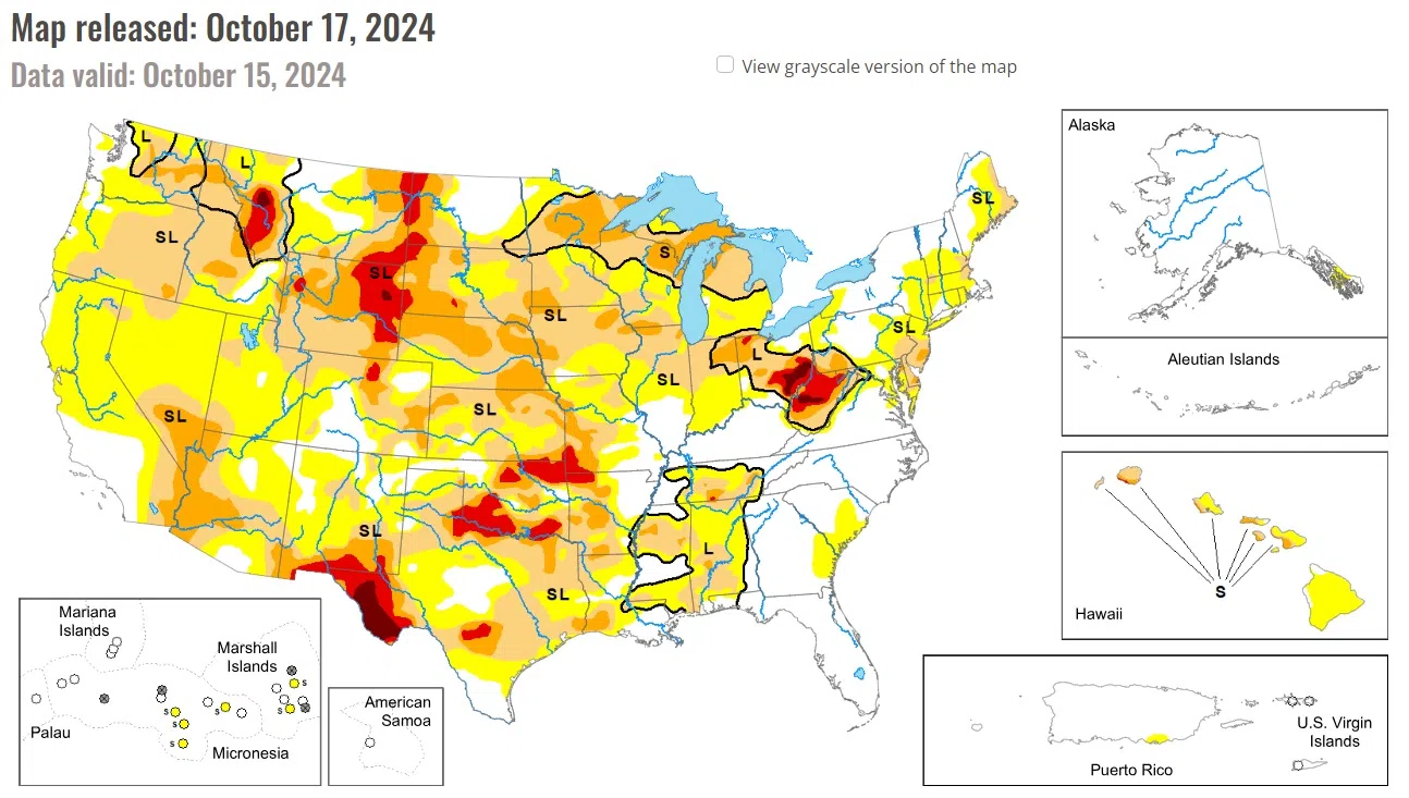
Precipitation across the country was pretty much nonexistent over the past week. The outliers were in Florida as Hurricane Milton came ashore and brought with it copious amounts of rain over much of the peninsula, as well as some rains in the upper Midwest into New England, and some coastal areas of the Pacific Northwest.
The dry pattern continued over the High Plains with only a small area of North Dakota recording any precipitation this week. The warm temperatures continued as well with most areas 4-8 degrees above normal and even greater departures of 8-12 degrees above normal in the plains of Wyoming and Colorado and portions of western Nebraska and South Dakota. Degradation took place from North Dakota to Kansas and into the plains of Montana, Wyoming, and Colorado. Moderate and severe drought were expanded in North Dakota, mainly in the south and west portions of the state. South Dakota had moderate and severe drought expand in the northern, southern, and western portions of the state and had extreme drought expand in the northwest and a new area in southern portions of the state.
Rain impacted the northern portions of Minnesota, Wisconsin, and into Michigan with some areas recording 100-150% of normal precipitation for the week. The rains brought some small improvements in northern Minnesota where severe drought eased to moderate drought. Other areas impacted by rain either slowed down the recent dry pattern or were not enough to flip the data to show improvements.
Severe drought expanded over northwest Iowa and southwest and northern Minnesota. Missouri had widespread degradation with moderate and severe drought expanding over central, southern, and western portions of the state and abnormally dry conditions filling in for central Missouri. Ohio had little change this week, with only some expansion of severe drought in the northwest and a slight improvement to moderate drought in the south.
National Drought Mitigation Center, University of Nebraska-Lincoln


Comments