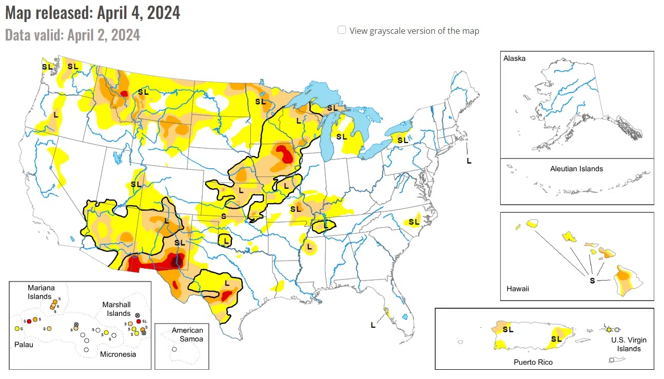
According to the week’s U.S. Drought Monitor from the National Drought Mitigation Center, an active early springtime pattern continued through late March and into the beginning of April. A pair of low pressure systems and trailing cold fronts tracked across the east-central contiguous U.S. (CONUS). A swath of 1 to 3 inches of precipitation supported improvements extending from parts of the Midwest to southeastern Kansa and northeastern Oklahoma. However, moderate drought (D1) was introduced to the lower Ohio Valley which has missed out on precipitation during the late winter and early spring. Increasing short-term dryness and periods of enhanced winds led to expansion of abnormal dryness (D0) and moderate drought (D1) in southwestern Kansas, northwestern Oklahoma, and western Texas.
The northern to central Great Plains along with the central Rockies remained either status quo this week or had a 1-category improvement. Locally heavy precipitation (more than 1 inch) led to targeted improvements across southeastern Kansas. Lighter precipitation (0.25 to 1 inch) supported minor improvements to South Dakota.
Heavy precipitation (1 to 3 inches, locally more) prompted 1-category improvements throughout southern Michigan, Ohio, Indiana, Illinois, Missouri, and eastern Iowa. However, the lower Ohio Valley continues to miss out on late winter and early spring precipitation which led to an expansion of moderate drought (D1) for this region.
Despite the improvements the past two weeks throughout much of the Midwest, long-term drought indicators continue to support varying levels of drought intensity including extreme drought (D3) in northeastern Iowa. According to USDA’s National Agricultural Statistics Service, 59 percent of Iowa topsoil moisture is rated as short to very short.
National Drought Mitigation Center, University of Nebraska-Lincoln


Comments