GRAND FORKS, ND (KFGO) – The Red River in Fargo-Moorhead is expected to reach its peak at a much lower level than earlier predicted.
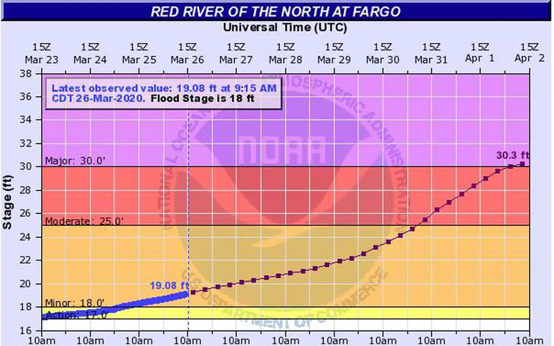
An updated flood outlook from the National Weather Service calls for a likely crest of between 31 and 33-feet late next week, just beyond 30-feet which is considered major flooding.
The lack of snow or rain and the past several weeks and a near-perfect snow melt has lessened the threat of serious flooding.
Fargo, with the help of volunteers, filled more than 220,000 sandbags earlier this month.
(information below, From NWS, Grand Forks)
Main Points –
– Slow/gentle thaw should continue into early April.
– Southern Red Basin through Fargo, opening up wide… with crest forecasts out for:
-the ND WIld Rice at Abercrombie – Between 19-21 ft, around April 1-4.
– the Red River at Fargo-Moorhead – Between 30-32 ft, around April 1-4.
– Central RRB will see significant thaw/snowmelt and runoff begining this next 7 days, with more rivers starting rise. But will need another week or more to push into moderate or major flood realm (mainly second week of April).
– Northern RRB will be later still.


Comments